Wildfire - Fire Map Info icon

Wildfire - Fire Map Info

2.0.6-internal for Android
3.4 | 5,000+ Installs | Reviews

QuantumTek Engineering

$0.99

Description of Wildfire - Fire Map Info

* The fastest way to view NOAA/USGS wildfire data *
CURRENT WILDFIRES
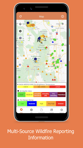
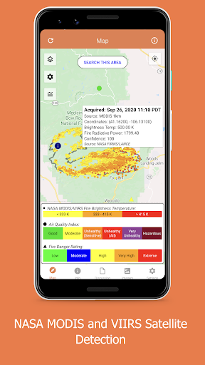
View NASA's near-realtime MODIS and VIIRS I-band fire detection data coupled with the USGS fire perimeter analysis.
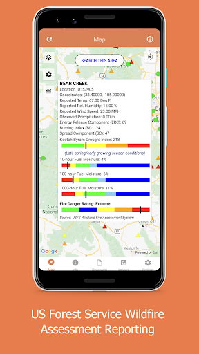
HAZARDOUS WILDFIRE CONDITION ZONES
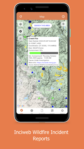
View detailed NOAA and USGS discussions of on-going wildfires and conditions.
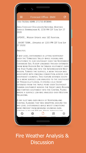
WEATHER DATA
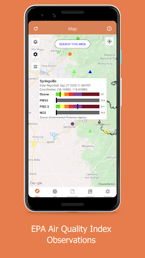
View near-realtime weather data overlays, including NOAA HD Weather Radar, Long Duration Hazards, Short Duration Watches & Warnings, Wind Speeds and Directions, and much more!
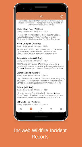
NEWS AND ANALYSIS:
View Current National Incidents and updates from responding agencies as well as Analysis Graphics provided from various Federal Fire and Weather Agencies
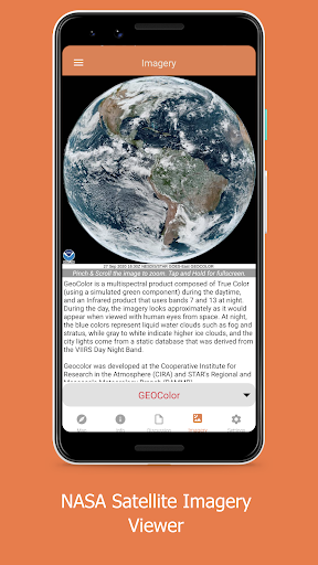
BEAUTIFUL BASE MAPS:
View data on Google Maps Normal, Satellite and Terrain Maps, USGS-provided Topographic maps or NASA Blue Marble maps!

Information

  • Category:
    Weather
  • Latest Version:
    2.0.6-internal
  • Updated:
    2020-12-26
  • Requirements:
    Android 0 or later
  • Developer:
    QuantumTek Engineering
  • ID:
    com.qtengineering.android.noaafireweather
  • Available on:
Reviews
  • avatar
    Good except it's like it doesn't show anything around my position
    2022-10-19 05:22
  • avatar
    Wonderful app doesn't make you purchase anything. And yet has fantastic information.
    2022-09-08 05:05
  • avatar
    I rely on it to be aware of air quality and potential risks in event of need to evacuate.
    2022-09-03 06:00
  • avatar
    Does what it claims.
    2021-09-23 04:36
  • avatar
    I reinstalled and its working Great even on my Fire tab. This is a must have in our area. THANK YOU
    2021-09-09 11:51
  • avatar
    Does not show fires on Amazon Fire tablet. Uninstalled
    2021-08-30 11:04