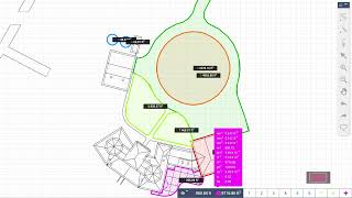
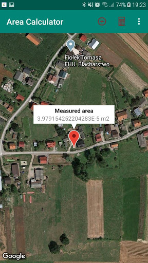
Application measure field surface using GPS data from your phone. Choose first point, press "plus" button stand steady and let your phone estimate your position. When system calculate your position sends notification. Then You can go to another point of your field. Repeat this steps as many times as many
breakpoints have your field, or just how many points You want to save. When you have all points You can press "calculator" button to calculate field surface.
User couldn't calculate area surface and draw results -- fixed this bug
9Apps 4.9