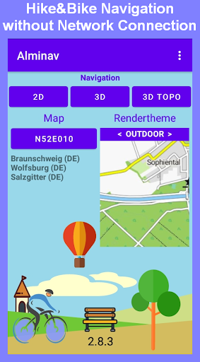
Alminav is designed for hikers, cyclists, and other outdoor enthusiasts. One of its main advantages is that it can function offline, as signals in the rural areas are often very weak. Maps can be downloaded in advance, and are vectored so as to not take up a lot of space in the phone's storage. Navigation works offline with downloaded maps.
FEATURES
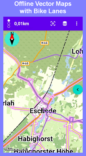
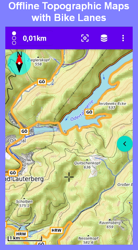
★ Offline detailed hiking maps
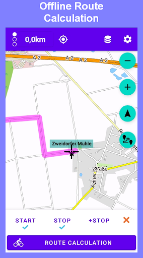
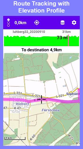
★ Offline route calculation with altitude profile
★ Offline search for cities, streets and pois
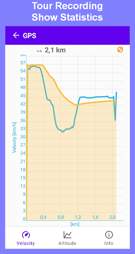
★ Record GPS tracks as KML or GPX file
★ Elevation charts
★ Velocity charts
★ Map styles can be choosed
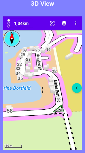
• Additional features in the 3D view
★ Display of the map in the direction of travel
★ The map can be displayed tilted (in perspective)
★ Buildings are shown 3-dimensional in large zoom levels
★ Display of marked cycle paths (in Germany)
★ Display of multiple routes
★ Use of topographic raster maps for Germany and the Alpine region
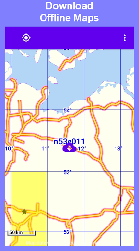
RECTANGULAR MAP TILES
The map tiles are all the same size and cover the rectangular area from one longitude and one latitude. Example: The tile n48e005 covers the area between the latitudes north 48° and 49° and between the longitudes east 5° and 6° (area about 100x100km). These tiles have a small download size, the route calculation is fast, they cover large parts of Europe.
For the area of Germany, marked cycleways can be displayed in the 3D view.
Country Maps
Country maps are less detailed than the map tiles, no contour lines are displayed and only car-navigation is possible.
• Austria
• Belgium
• Denmark
• France
• Germany
• Greece
• Italy
• Netherlands
• Poland
• Spain
• Switzerland
• Czech Republic
• Hungary
Maps are based on the data of OpenStreetMap (OSM).
UPGRADE
The limitation of maps import can be removed by in app purchases. One map tile can be imported for free.
APIS
• Vector maps rendering: http://wiki.openstreetmap.org/wiki/Mapsforge
• Route calculation: http://graphhopper.com
• Map download: https://firebase.google.com/


9Apps 4.9


