Welcome to our app recommend. 30,000+ users downloaded Gourette 3D latest version on 9Apps for free every week! With unexpected, recently it has become very popular in India. This hot app was released on 2019-07-24. Here are some guides of this app:
Découvrez Eaux-Bonnes - Gourette et ses activités de pleine nature, grâce à la 3D et descriptifs de l'application en relief.
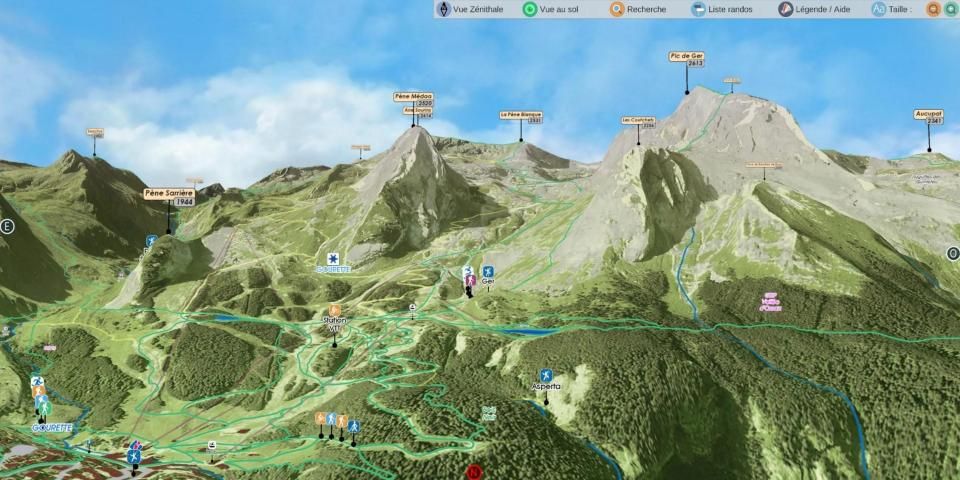
Parcourez la station de Gourette, le village de Eaux-Bonnes et les environs sur les sentiers, toutes les balades pour les débutants et les randonneurs, la marche nordique, le trail ou le VTT.
Découvrez les sites d'escalade et de canyoning.
Eaux-Bonnes - Gourette vous propose cette application 3D pour découvrir la station et les environs en 3D immersive.
L'application Eaux-Bonnes Gourette est interactive et immersive :
Profitez pleinement des avantages de ce guide embarqué et sa carte réaliste.
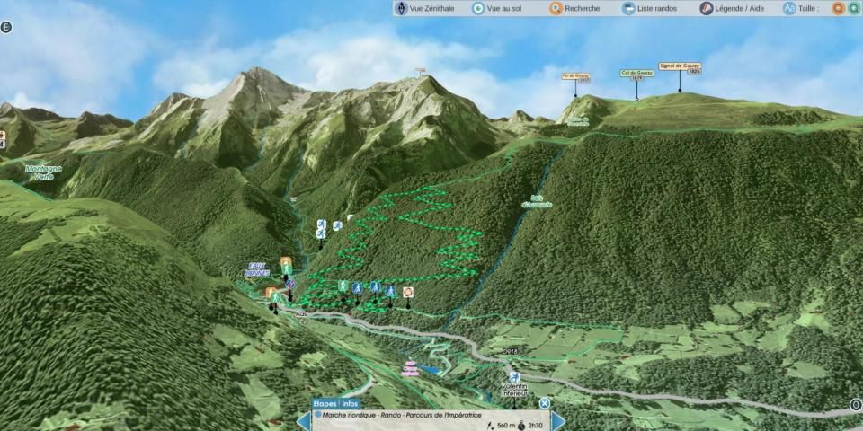
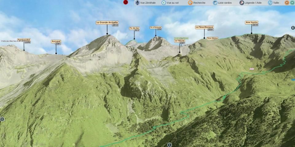
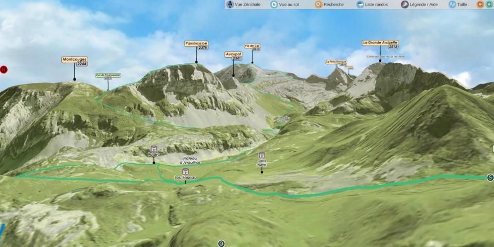
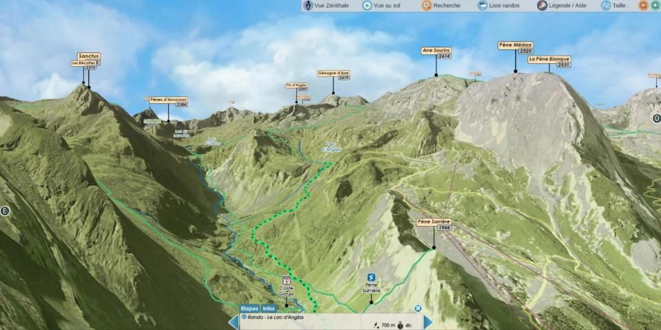
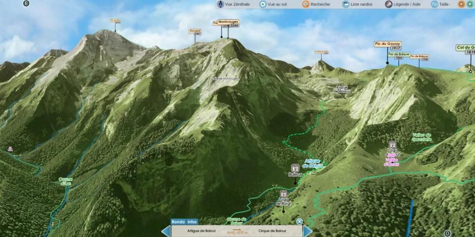
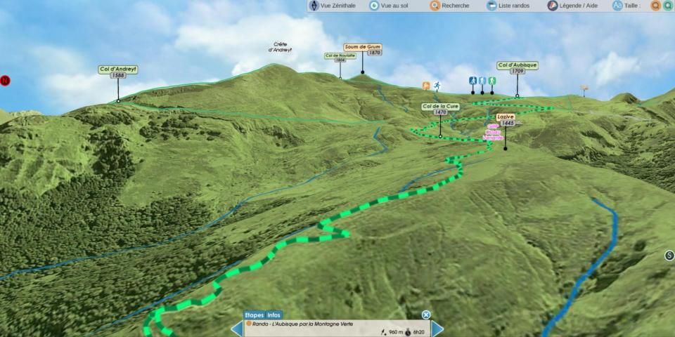
La description des itinéraires est détaillée dans l'illustration dynamique 3D.
Toutes les fonctionnalités sont très simples à utiliser et accessibles HORS LIGNE, montagne oblige.
FONCTIONS IMMERSIVES 3D
○ Commandes intuitives et précises... du bout des doigts.
○ Vue aérienne, survol
○ Vue et déplacement au sol
○ Boussole
○ Géolocalisation
GUIDE & DESCRIPTIFS
○ Descriptifs précis, texte et visuels
○ Affichage direct dans la 3D
GPS
Le GPS de votre téléphone est utilisé pour la géolocalisation sur la zone cartographiée, il est particulièrement utile pour voir sa position dans le relief, surtout en cas de mauvaise visibilité sur le terrain.
BOUSSOLE
Le mode boussole est intégré dans la 3D, les points cardinaux s’orientent selon les mouvements manuels ou la carte s’oriente automatiquement au Nord en activant le mode boussole directement depuis la 3D.
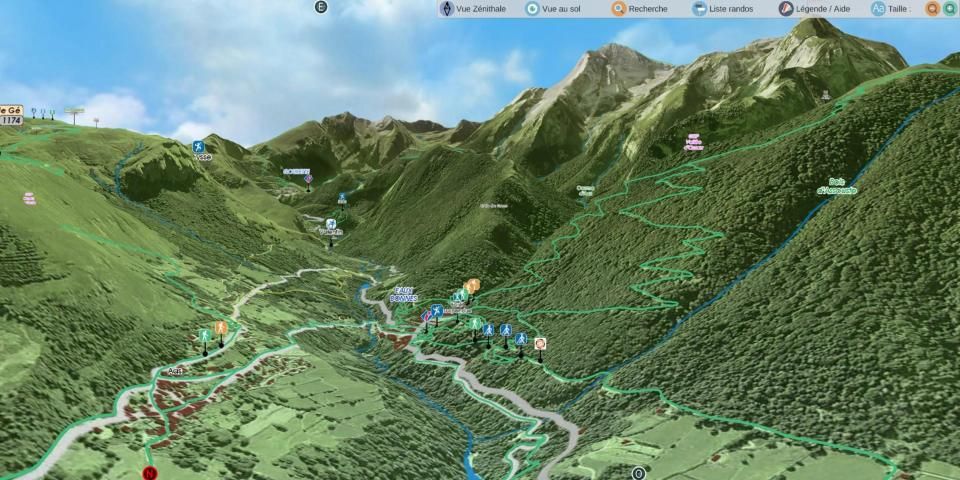
RELIEF & VUE AU SOL 3D
La vue aérienne et la vue au sol illustrent le relief général à un niveau de précision optimisé, elle s’affiche à l’écran en fonction de la définition du relief et de texture choisis au lancement de l’application, chargées automatiquement ou à sélectionner selon les capacités de l’appareil utilisé.
Le déplacement de la caméra au sol permet d’apprécier les détails de l’itinéraire à suivre et totale immersion dans le relief.
Application Interactive 3D Guide de randonnée - Face au Sud ® TOPOMAP3D ® www.faceausud.com
Marque et Modèles déposés 486299 08082013 - 12 3 953 606 © Tous droits réservés - Reproduction interdite.
Avec l'aimable participation de Helge Foerster jPCT 3D engine ® www.jpct.net Copyright © 2010
Discover Eaux-Bonnes - Gourette and its outdoor activities, thanks to 3D and descriptive of the application in relief.
Visit the Gourette resort, the village of Eaux-Bonnes and the surrounding area on the trails, all walks for beginners and hikers, Nordic walking, trail running or mountain biking.
Discover the climbing and canyoning sites.
Eaux-Bonnes - Gourette offers you this 3D application to discover the resort and the surroundings in immersive 3D.
The application Eaux-Bonnes Gourette is interactive and immersive:
Enjoy the benefits of this onboard guide and realistic map.
The description of the itineraries is detailed in the 3D dynamic illustration.
All features are very simple to use and accessible OFFLINE, mountain requires.
3D IMMERSIVE FUNCTIONS
○ Intuitive and precise controls ... with your fingertips.
○ Aerial view, overflight
○ View and movement on the ground
○ Compass
○ Geolocation
GUIDE & DESCRIPTIVE
○ Precise, textual and visual descriptions
○ Direct display in 3D
GPS
The GPS of your phone is used for geolocation on the mapped area, it is particularly useful to see its position in the terrain, especially in case of poor visibility in the field.
COMPASS
The compass mode is integrated in the 3D, the cardinal points are oriented according to the manual movements or the card is automatically oriented to the North by activating the compass mode directly since the 3D.
RELIEF & 3D GROUND VIEW
The aerial view and the ground view illustrate the general relief at an optimized level of precision, it is displayed on the screen according to the definition of relief and texture chosen at launch of the application, automatically loaded or select depending on the capabilities of the device used.
The movement of the camera on the ground makes it possible to appreciate the details of the route to be followed and total immersion in the relief.
Interactive 3D Application Trekking Guide - South Facing ® TOPOMAP3D ® www.faceausud.com
Trademark and registered design 486299 08082013 - 12 3 953 606 © All rights reserved - Reproduction prohibited.
With the kind participation of Helge Foerster jPCT 3D engine ® www.jpct.net Copyright © 2010
Descriptifs en Anglais - Espagnol
Menus en Anglais - Espagnol - Allemand - Italien
9Apps 4.9


