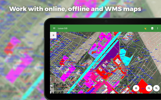
Offline Fieldwork နှင့် Geodata နှင့်အတူ Offline Fieldwork အတွက် Professional GIS application ။၎င်းသည်ဒေတာစုဆောင်းခြင်း, ကြည့်ရှုခြင်းနှင့်မွမ်းမံခြင်းတို့ကိုထောက်ပံ့ပေးသည်။၎င်း၏အင်္ဂါရပ်များအားလုံးအွန်လိုင်း, အော့ဖ်လိုင်းနှင့် WMS မြေပုံများကျယ်ပြန့်စွာရွေးချယ်ခြင်းရှိသည်။
•အော့ဖ်လိုင်းဒေတာများကိုစုဆောင်းခြင်းနှင့်မွမ်းမံခြင်းလက်ရှိသို့မဟုတ်မတရားရာထူး
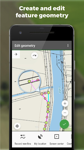
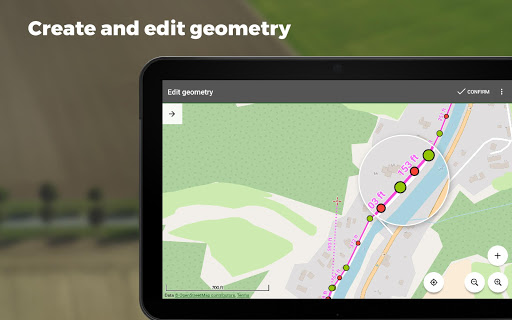
•ရွေ့လျားမှုမှတ်တမ်းတင်ခြင်းဖြင့်လိုင်းများနှင့်အနားများဖန်တီးခြင်း• attribute များ၏ချိန်ညှိချက်များဖန်တီးခြင်း (
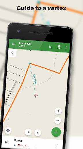
Polygon / Line Recording သို့မဟုတ် Target တွင်လမ်းညွှန်ခြင်းသို့မဟုတ်ရည်မှန်းချက်ရေးဆွဲခြင်းသည်နောက်ခံတွင် 0 င်ရောက်ခြင်းကိုပြုလုပ်သည်။
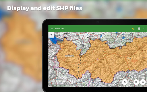
data to ESRI SHP or CSV files
• exporting whole projects to QGIS
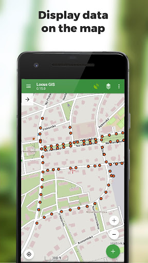
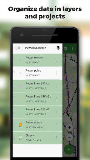
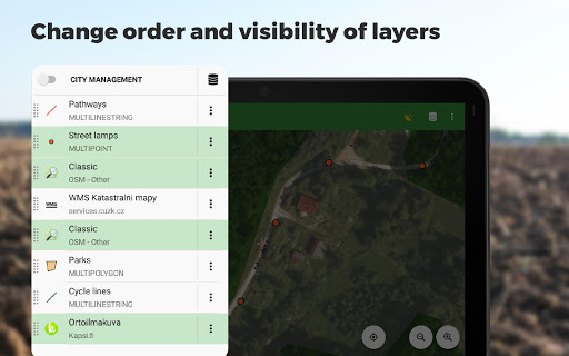
Maps
• wide range of maps both for online use and for download
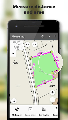
• supportWMS Sems MOTSSES, SQLITE, MASTFACE, GEMP, RMAP ပုံစံများ, CustomStreetMap formation များနှင့်မြေပုံခေါင်းစဉ်များရှိအော့ဖ်လိုင်းမြေပုံများကိုထောက်ခံခြင်း> •အကွာအဝေးနှင့်ဒေသများတိုင်းတာခြင်း
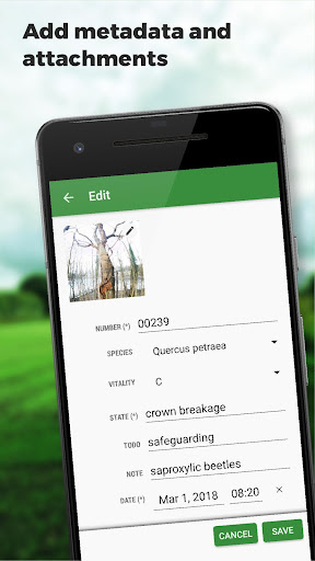
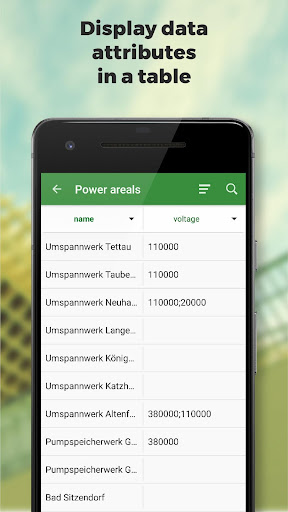
attribute table တွင်အချက်အလက်များကိုရှာဖွေခြင်းနှင့်စစ်ထုတ်ခြင်းများ•စတိုင်တည်းဖြတ်ခြင်းနှင့်စာသားတံဆိပ်များကိုစာရင်းပြုစုခြင်း
Locus GISSစက်မှုလုပ်ငန်းအမျိုးမျိုးတွင်အောင်မြင်စွာအသုံးပြုသည် -
•ပတ် 0 န်းကျင်ဆိုင်ရာအချက်အလက်များ (ဂေဟစနစ်စကင်ဖတ်စစ်ဆေးမှု, သစ်ပင်စစ်ခြင်း,> •သဘာဝဓာတ်ငွေ့နှင့်စွမ်းအင်ဖြန့်ဖြူးခြင်း
•လေယာဉ်ခြံများတည်ဆောက်ခြင်းနှင့်ဆောက်လုပ်ခြင်း
•သတ္တုတူးဖော်ရေးနယ်ပယ်များနှင့်ရေတွင်းများရှာဖွေခြင်းကိုရှာဖွေခြင်း
•မြို့ပြအဆောက်အအုံများကိုစစ်တမ်းကောက်ယူခြင်းနှင့်စီမံခန့်ခွဲမှု
*** 1.21.4 ***
- add: option to add multiple independent WMS layers from one WMS service
- add: Automatic resize of photo attachments. See Settings > Miscellaneous
- chg: Improved start of application
- fix: Defunct creating of new points during recording a new line or polygon by movement
- fix: Defunct import of older project templates
- fix: Style settings screen not working on some tablets
- fix: unwanted export of deleted attributes to the template


9Apps 4.9


