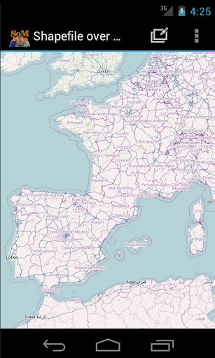
あなたのモバイルデバイスのSDカードから直接この地理情報システム(GIS)であなた自身のシェープファイルをロードし、それらをマップ上で視覚化します。 DBFテーブルの値を編集してオフラインモードで使用することもでき、メモリカードからマップをロードすることもできます。
このGISアプリケーションでは、SHPファイルを選択してロードしたり、フォルダ全体を自動的にロードできます。
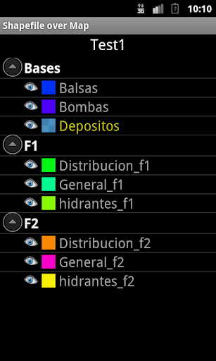
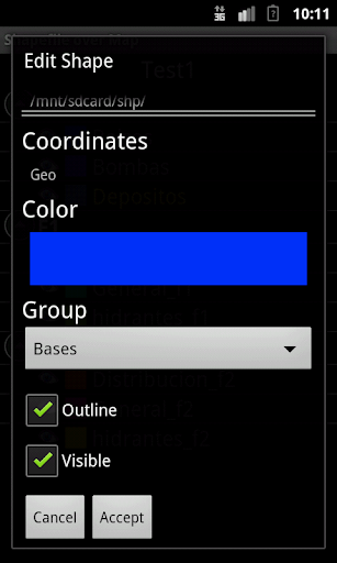
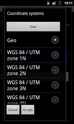
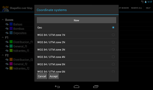
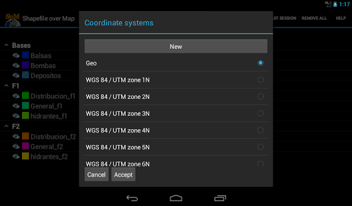
これらのSHPファイルのいずれかを選択して、アクティブレイヤーとしてマークすると、そのうちの1つを長く押すと、その座標系、色、または目に見えないようにすることができます。
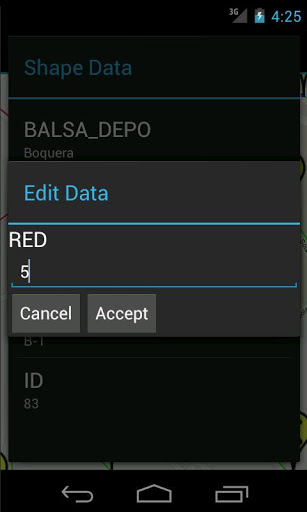
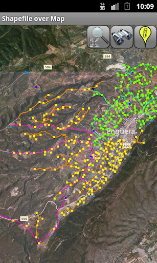
マップが表示されますアクティブレイヤー内の各レコードに属する一連のアイコンが、それに応じて、対応する属性テーブルから情報を表示および編集できます。
アプリケーションはまた、GPSを介して現在の位置を表示し、その上にマップを中心にすることもできます。
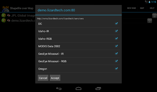
複数のオンラインマップサーバーの間で選択できます。
これはデモバージョンです。いくつかの機能はフルバージョンでのみ利用可能です。
Support for all UTM Projections.
The .prj file is readed and the coordinate system is automatically assigned.
Now you can save your sessions (a configured shapefile list).
New drawing system. Now move the map is faster
New layers administration system
New tool to load the last session
New auto zoom tool to the active layer
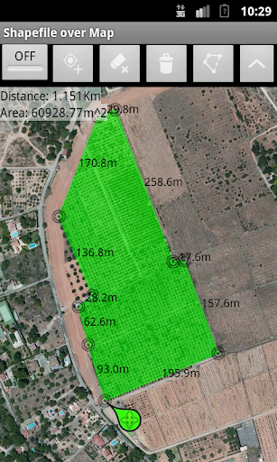
Added new tool to measure distances, areas and perimeters (Full version only)
Added new map servers: Road, Aerial and Aerial with labels(Full version only)
9Apps 4.9