Get the best free apps for your android phones. 30,000+ users downloaded SatFinder latest version on 9Apps for free every week! It is simply to learn how to use it. This hot app was released on 2018-09-27. I believe that if you are an android apps lover, you would not miss it.
sattelite director - Dish Pointer is a tool for finding TV satellites and aligning satellite dishes. Use you AR camera view to see and target satellites in the sky.
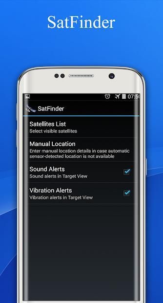
*New feature: Ability to manually enter Location latitude and longitude details in case Location cannot be automatically determined in case of "no connectivity"
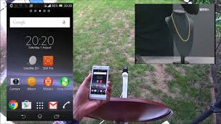
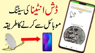
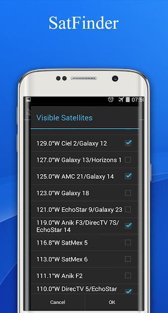
satellite locator - Satfinder uses your phone sensors to detect your physical location and calculates azimuth and elevation needed for your satellite antenna to face.
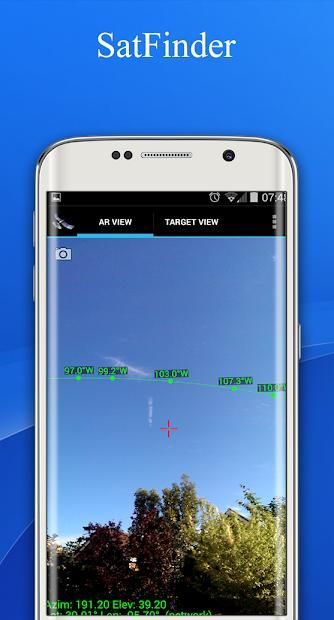
Augmented Reality View:
Use your camera for Augmented Reality View which paints the satellite icons in places where they're positioned in the sky. It gives a realistic view to the sky and it helps to make sure there is a line of sight (LOS), i.e. no obstacles, such as tree branches or house tops, between the satellite dish and the satellite itself.
- Touch screen to take a screenshot of Augmented Reality view
- Pinch to zoom satellites in and out. Double tap to reset.
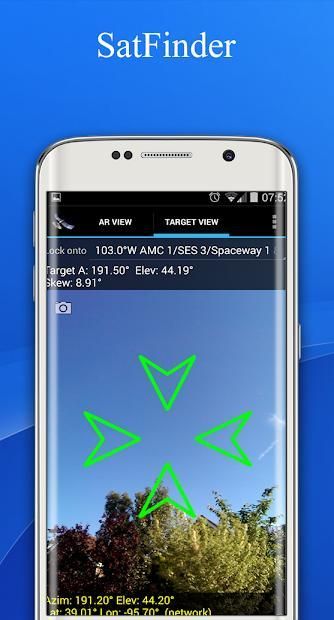
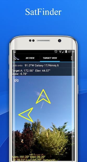
Target Satellite View:
Use Target Satellite View to find or to "lock onto" a particular satellite. Direction arrows simply guide you to the desired satellite position.
sutradara sattelite - Dish Pointer adalah alat untuk menemukan satelit TV dan menyelaraskan piring satelit. Gunakan Anda tampilan kamera AR untuk melihat dan menargetkan satelit di langit.
* Fitur baru: Kemampuan untuk memasukkan informasi garis lintang dan bujur secara manual jika Lokasi tidak dapat ditentukan secara otomatis jika "tidak ada konektivitas"
pencari satelit - Satfinder menggunakan sensor ponsel Anda untuk mendeteksi lokasi fisik Anda dan menghitung azimuth dan elevasi yang diperlukan untuk antena satelit Anda untuk menghadapinya.
Augmented Reality View:
Gunakan kamera Anda untuk Augmented Reality View yang melukis ikon satelit di tempat-tempat di mana mereka diposisikan di langit. Ini memberikan pandangan yang realistis ke langit dan membantu memastikan ada garis pandang (LOS), yaitu tidak ada hambatan, seperti cabang-cabang pohon atau puncak rumah, antara parabola dan satelit itu sendiri.
- Layar sentuh untuk mengambil screenshot tampilan Augmented Reality
- Cubit untuk memperbesar dan memperkecil tampilan satelit. Ketuk dua kali untuk mengatur ulang.
Target Tampilan Satelit:
Gunakan Target Tampilan Satelit untuk menemukan atau untuk "mengunci ke" satelit tertentu. Panah arah hanya memandu Anda ke posisi satelit yang diinginkan.
9Apps 4.9