


Download and enjoy our service, 20,000+ users downloaded Europe 3D latest version on 9Apps for free every week! Fortunately, It's easy to get this popular app. This hot app was released on 2019-03-30. It is a very popular app on India now.
How would you like a mapping app with routing and GPS tracking that offers you the BEST 3D VISUALIZATION for the outdoors?
How would you like a mapping app that shows points of interest in 3D with info or links to embedded Wikipedia pages?
GeoFlyer Europe 3D offers you all this and more!
The app is provided as a
free Lite version
, then a subscription or a permanent license purchase is available.
If you love hiking, biking, horseback riding, or any other outdoor activity, GeoFlyer 3D Maps is the app you need.
MAIN FEATURES
- Online and Offline modes (with preloading of selected areas)
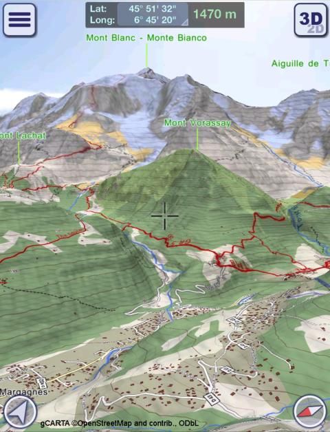
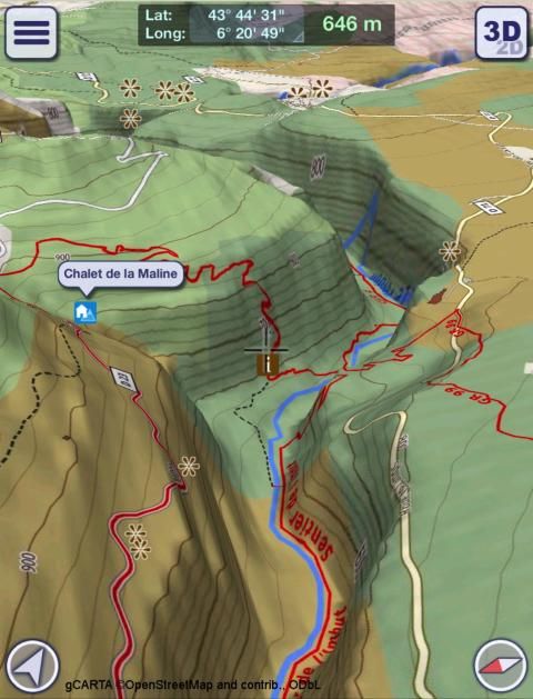
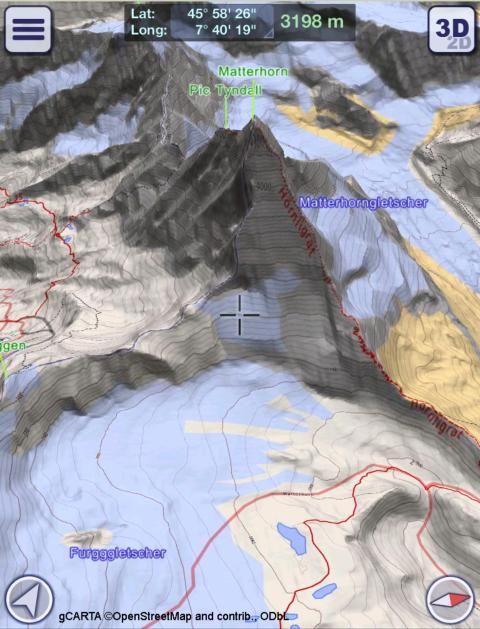
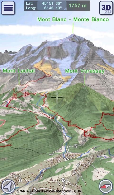
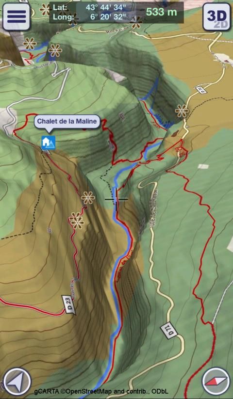
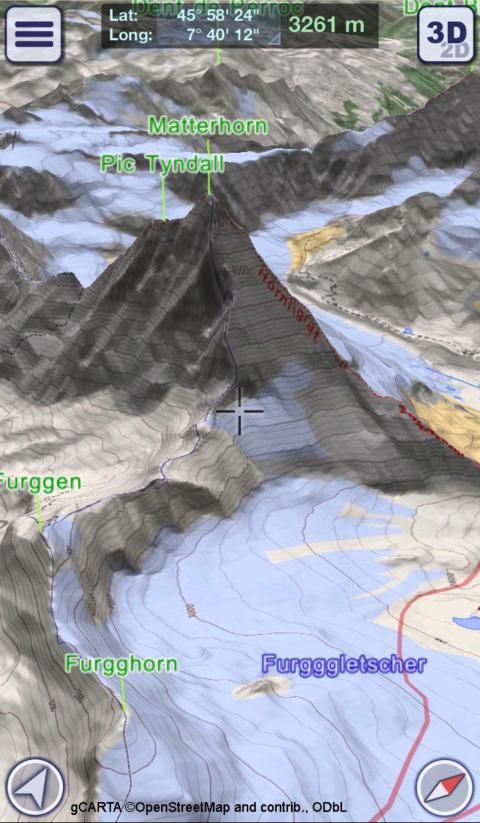
- Highly-detailed 3D terrain
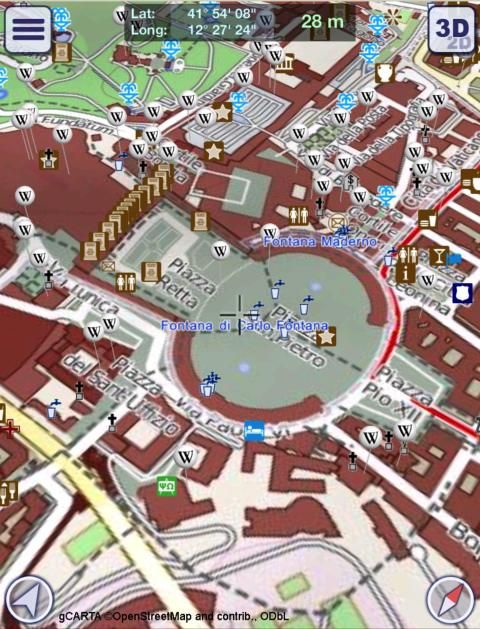
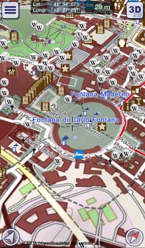
- 3D labels/icons of Points of Interest (POIs)
- Integrated Wikipedia descriptions
- Place searching by name (Online and Offline)
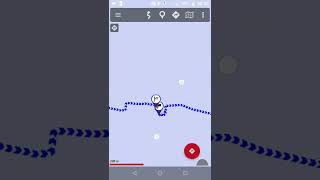
- GPS tracking
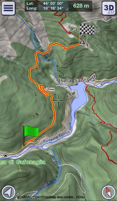
- Routing
- Personal Points of Interest (POIs)
- Import, export and share of tracks and routes with your friends and among your devices
- Altimetry graph and statistics
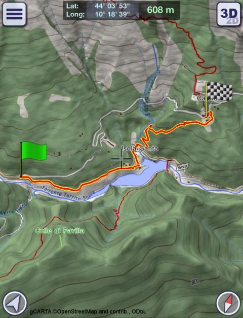
- Custom-made gCARTA topographic chart
- Augmented Reality Module
- Gyroscope features: GyroPilot
GeoFlyer Europe 3D reproduces the terrain in 3D with stunning details, using the best available digital elevation models from NASA and various European mapping agencies.
The terrain is overlaid with a custom-made topographic chart (gCARTA) that shows trails and accurate elevation contour lines, or aerial images if you prefer.
Find out more about a POI using the labels and icons. Wikipedia geo-tagged entries and other associated content are integrated right into the 3D map.
Plan your trip using multiple routing options, and save your routes for later use.
Record your GPS tracks and share them with your friends through Facebook or other social media.
Get the best from your outdoor experience with the “Augmented Reality” module, that enables to discover many details about the environment around you, thanks to the overlapping of points of interest and geographic names on the image taken by the camera.
And it’s fun! Try the GyroPilot mode: dive into the valleys with a low level flyby, handling your device like a virtual plane, and explore the maps like a top-gun pilot!
GeoFlyer Europe 3D… your outdoor companion!
WARNING
Continued use of GPS running in the background can dramatically decrease battery life.
Bagaimana Anda ingin aplikasi pemetaan dengan routing dan pelacakan GPS yang menawarkan Anda VISUALISASI 3D TERBAIK untuk di luar ruangan?
Bagaimana Anda ingin aplikasi pemetaan yang menunjukkan tempat menarik di 3D dengan info atau link ke tertanam halaman Wikipedia?
GeoFlyer Eropa 3D menawarkan semua ini dan lebih!
Aplikasi ini disediakan sebagai
bebas versi Lite , kemudian berlangganan atau pembelian lisensi permanen tersedia.
Jika Anda menyukai hiking, bersepeda, berkuda, atau kegiatan outdoor lainnya, GeoFlyer 3D Maps adalah aplikasi yang Anda butuhkan.
FITUR UTAMA
- Online dan Offline mode (dengan preloading dari daerah yang dipilih)
- medan 3D sangat-rinci
- label 3D / ikon Tempat Tujuan (POI)
- deskripsi Terpadu Wikipedia
- Tempat pencarian dengan nama (Online dan Offline)
- pelacakan GPS
- Routing
- Poin Pribadi Menarik (POI)
- Impor, ekspor dan berbagi trek dan rute dengan teman-teman Anda dan di antara perangkat Anda
- Grafik Altimetri dan statistik
- Custom-made gCARTA grafik topografi
- Modul Augmented Reality
- fitur Gyroscope: GyroPilot
GeoFlyer Eropa 3D mereproduksi medan dalam 3D dengan detail yang menakjubkan, dengan menggunakan terbaik yang tersedia model elevasi digital dari NASA dan berbagai lembaga pemetaan Eropa.
medan dilapis dengan grafik topografi custom-made (gCARTA) yang menunjukkan jalan dan garis kontur elevasi akurat, atau foto udara jika Anda inginkan.
Cari tahu lebih lanjut tentang POI menggunakan label dan ikon. Wikipedia geo-tagged entri dan konten terkait lainnya benar terintegrasi ke dalam peta 3D.
Rencanakan perjalanan Anda menggunakan beberapa pilihan routing, dan menyimpan rute Anda untuk digunakan nanti.
Merekam lagu GPS Anda dan membaginya dengan teman-teman Anda melalui Facebook atau media sosial lainnya.
Mendapatkan yang terbaik dari pengalaman di luar ruangan Anda dengan “Augmented Reality” modul, yang memungkinkan untuk menemukan banyak rincian tentang lingkungan di sekitar Anda, berkat tumpang tindih tempat menarik dan nama-nama geografis pada gambar yang diambil oleh kamera.
Dan itu menyenangkan! Mencoba modus GyroPilot: menyelam ke dalam lembah dengan tingkat terbang lintas rendah, penanganan perangkat seperti pesawat virtual, dan menjelajahi peta seperti pilot top-gun!
GeoFlyer Eropa 3D ... pendamping di luar ruangan Anda!
PERINGATAN
Terus menggunakan GPS berjalan di latar belakang dapat secara dramatis mengurangi masa pakai baterai.
- Fixed a bug about label visibility.
- Fixed other minor bugs.
9Apps 4.9