
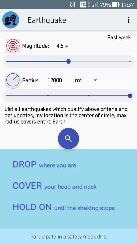
Choose magnitude 2.5+ or 4.5+ or significant, and define a circular region in which you want to know about earthquake occurrences by choosing radius between 500 - 12,000 mile, device location is the center of the circle. Time options are dependent on magnitude.
Salient Features:-
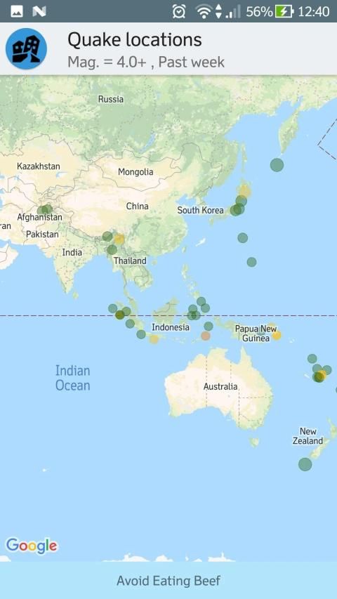
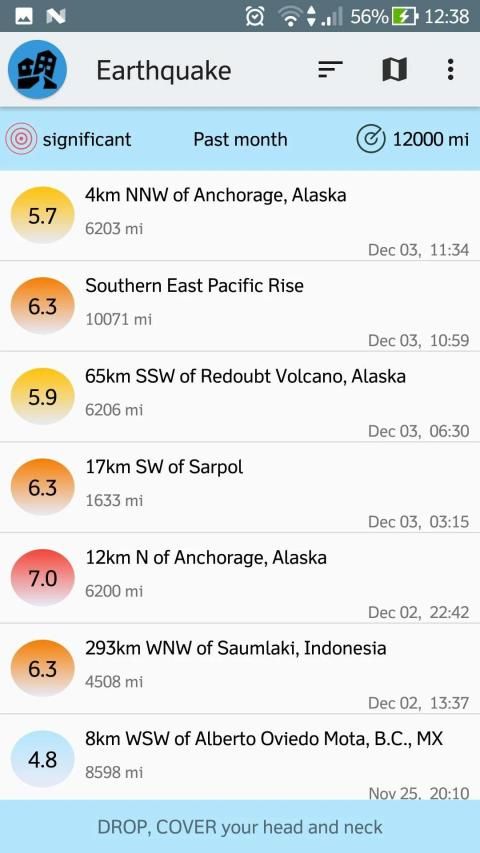
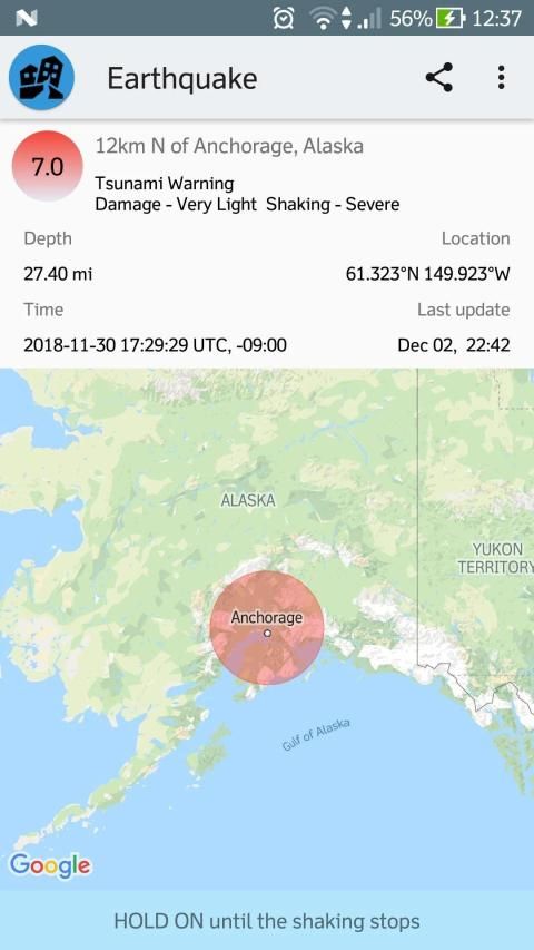
- List / map view
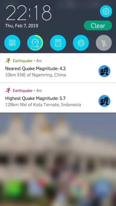
- notification shows highest and nearest quake magnitude in a defined region and time
- Share earthquake information
- Magnitude, time options: 2.5+ past day; 4.5+, past week; significant, past month
- Update time: time when earthquake data is recorded on usgs.gov.
- Real time: time in UTC when earthquake really occurred.
- time zone of the affected area
- Depth in (km/mile) and Geo-coordinates(Latitude, Longitude)
data source: US Geological Survey
परिमाण 2.5+ या 4.5+ या महत्वपूर्ण चुनें, और एक गोलाकार क्षेत्र को परिभाषित करें जिसमें आप 500 - 12,000 मील के बीच त्रिज्या चुनकर भूकंप की घटनाओं के बारे में जानना चाहते हैं, उपकरण का स्थान सर्कल का केंद्र है। समय विकल्प परिमाण पर निर्भर हैं।
मुख्य विशेषताएं:-
- सूची / नक्शा देखें
- अधिसूचना एक परिभाषित क्षेत्र और समय में उच्चतम और निकटतम भूकंप की तीव्रता दिखाती है
- भूकंप की जानकारी साझा करें
- परिमाण, समय विकल्प: 2.5+ पिछला दिन; 4.5+, पिछले सप्ताह; महत्वपूर्ण, पिछला महीना
- अपडेट समय: वह समय जब भूकंप का डेटा usgs.gov पर रिकॉर्ड किया जाता है।
- वास्तविक समय: UTC में समय जब भूकंप वास्तव में आया।
- प्रभावित क्षेत्र का समय क्षेत्र
- (किमी / मील) और भू-निर्देशांक (अक्षांश, देशांतर) में गहराई
डेटा स्रोत: अमेरिकी भूवैज्ञानिक सर्वेक्षण
Notification shows nearest quake info also.
9Apps 4.9

![How to Enable Earthquake Alerts on Android [QUICK GUIDE] screenshot 1](https://i.ytimg.com/vi/jGGnnhIy8_E/mqdefault.jpg)


